![]()
![]()
![]()
![]()
![]()
![]()
![]()
![]()
![]()
![]()
![]()
![]()
AUTOSTRADA PEDEMONTANA LOMBARDA
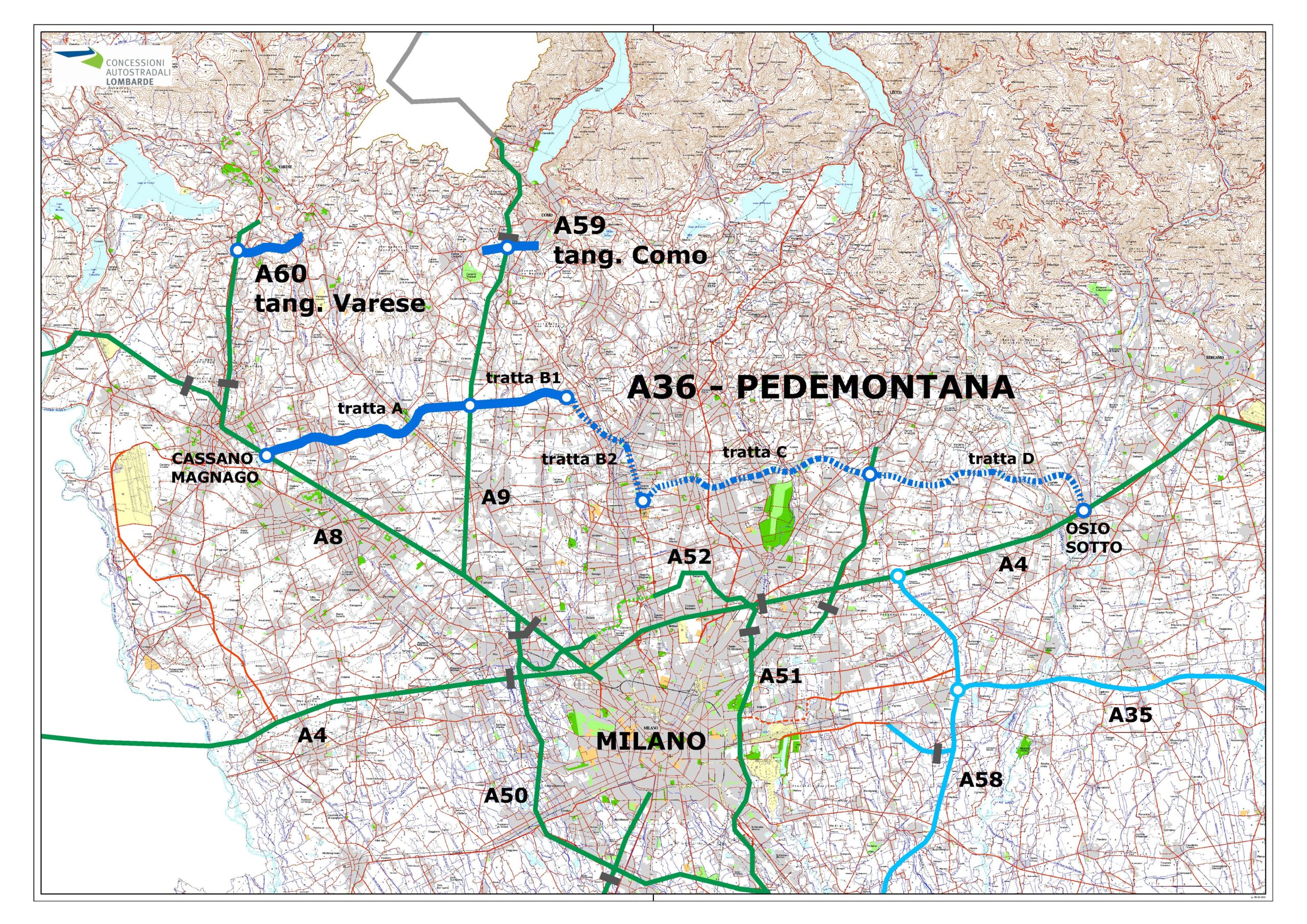
The Pedemontana Lombarda Motorway is a road system with a total development of about 157 km, of which 67 km of motorway, 20 km of ring roads and 70 km of local road network. This is a very complex intervention, both at the engineering and environmental level, for the remarkable development of the route, the importance of the connected infrastructure and the type of territory crossed (the densely populated and industrialized area north of Milan, from Varese to Bergamo).
The Pedemontano Road System consists of the following road infrastructures:
A motorway axis (67 km) from Cassano Magnago (VA) to Osio Sotto (BG), connecting the existing A8 Milano-Varese, A9 Milano-Como and A4 Torino-Venezia motorways.
The ring roads of Como and Varese (20 km).
A system of “connected works” and “local road works”, for a total of 21 interventions and a total development of 70 km, in order to improve the connection with the ordinary, main and secondary road network.
Through the realization of the Pedemontana Lombarda, we intend to pursue the following goals:

APPROVAL OF PRELIMINARY PROJECT
APPROVAL OF FINAL PROJECT
WORK START (ROUTE- "A" )
ENTRY INTO OPERATION ROUTE "A" AND FIRST TANGENTIAL LOTS
ENTRY INTO OPERATION ROUTE "B1"
For the realisation of 73 km of motorway.
For the construction of new ordinary roads or the redevelopment of existing roads at provincial and municipal level, for a total development of 68 Km.
For environmental mitigation and redevelopment of the territories crossed.
For expropriation and resolution of interference with existing systems.
For safety on construction sites.
For activities at the expense of the Contracting Station: planning, construction management, testing, monitoring, testing, unforeseen events.
The Dalmine - Como - Varese - valico del Gaggiolo motorway link pass, known as the Pedemontana Lombarda motorway, belongs to the TEN-T trans-European road transport network. In particular, the motorway contributes to the development of the east-east strategic axis along the European corridor n. 3 "Mediterranean". TEN-T networks are a set of linear infrastructure (rail, road and river) and punctual (urban nodes, ports, interports and airports) considered relevant at community level and the Core Network is made up of urban nodes with higher population density, the most important intermodal nodes and their connections.
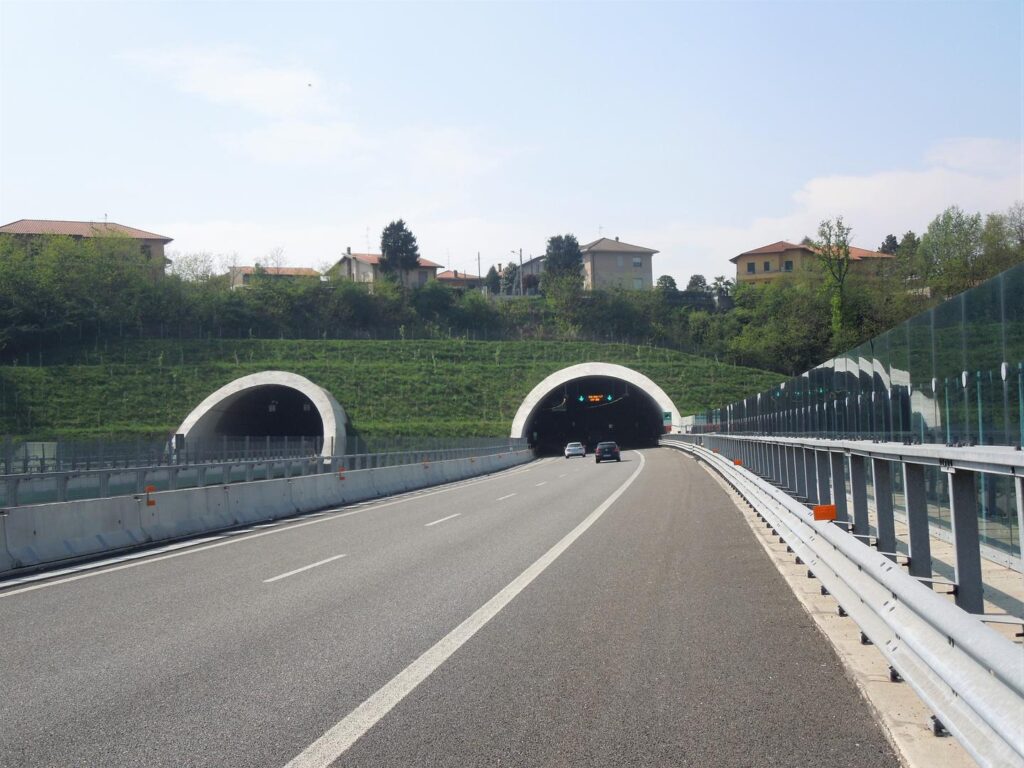
Pedemontana Lombarda differs from the existing highways especially in how it will cross the territory. To minimize its environmental impact and the difficulty of crossing one of the most built-up areas in Europe, it runs for almost three-quarters of the 87 kilometers expected below the level of the countryside, in trenches and natural or artificial tunnels.
Pedemontana Lombarda crosses 5 important Lombard rivers: the Olona, the Seveso, the Lambro, the Adda and the Brembo, through the construction of bridges and viaducts that altogether extend for about 6 km. Of these, the two main crossings, Olona and Adda, will take place at half cost to reduce the length and reduce the impact. Despite this, the bridge over the Adda will still be less than a kilometer long and being destined to become part of the landscape, as in the case of the bridge over the Lambro, the design proposal has been particularly accurate.

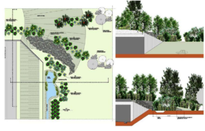
Of particular importance are the local environmental redevelopment projects, which involve 44 municipalities: interventions located in parks and municipalities crossed by the road, or located in areas of particular environmental value, which strengthen environmental systems north-south and support the east-west corridor design of the Greenway;
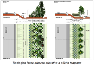
Particular attention has been paid to environmental mitigations, consisting of several interventions and technical solutions, mainly adjacent to the motorway and local scale, useful to "limit" the visual and acoustic impact of the work on the territory. Instead of realizing, as it usually happens, specific micro-interventions with minimal territorial impact, Autostrada Pedemontana Lombarda preferred to prioritize widespread actions, aimed at the construction of new landscapes. Not a simple screening of the road layout, but a double opportunity to strengthen the system of ecological corridors, redeveloping the gates occupied, and redevelop fringe areas characterized by loss of landscape quality. The mitigations create a wide green strip, of variable extension, perceptible not only by the users of the highway, but publicly and ecologically usable.
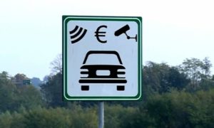
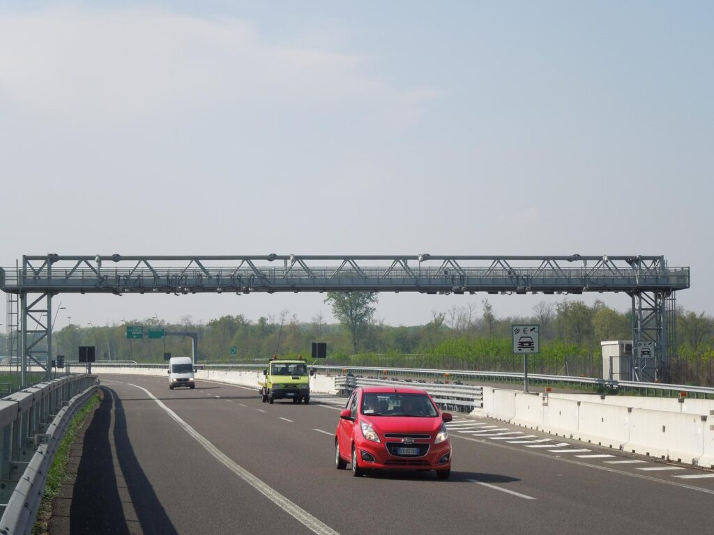
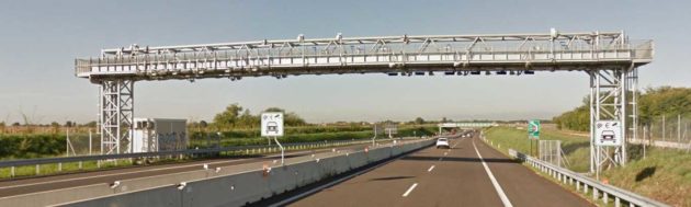
Autostrada Pedemontana Lombarda is the first Italian motorway that allows you to travel without ever having to stop at the toll, this thanks to the new collection system Free Flow. The Free flow system does not require the presence of toll booths. You can travel without ever finding barriers and the usual boring queues that take away time and increase pollution.
The Free Flow system is equipped with special support structures (called portals) that cover the entire roadway on which technological equipment is installed thanks to which the license plates of all vehicles in transit can be photographed and detected. The data collected by the portals are then transmitted to the central system for the subsequent identification of the owner and the cost of the toll.
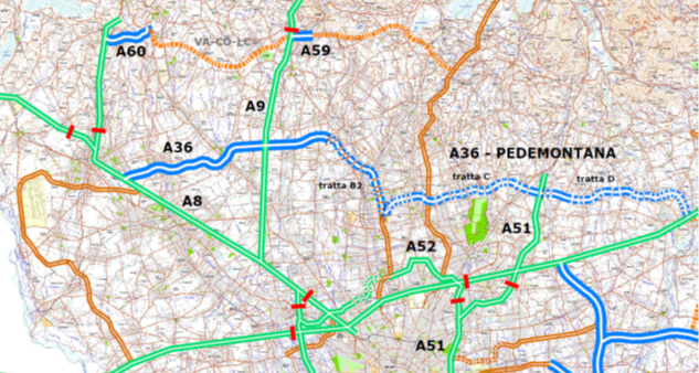
Pedemontana does not stop! Currently the necessary tenders are underway (advanced phase) to identify the manufacturer for the construction of the new B2 and C sections, which will extend the Pedemontano connection to interconnect with the A51 Tangenziale Est in Milan.
Reduced transport cost (time, fuel, operating costs).
Improvement of the delicate relationship between infrastructure and environment, with positive effects on the landscape and noise and air pollution, especially in the vicinity of residential areas.
Reduced accident rates thanks to the high safety standards of the new motorway.
Greater competitiveness of existing enterprises; new settlements.
Generated by new settlements and the growth of existing businesses.
Integration of the network of the great regional viability, through the interconnection of the great radials on Milan
Reorganization of the entire pedemontano road system, with displacement of important quotas of traffic and consequent reduction of the current situations of crisis of the ordinary practicability.
Decongestion of the current Milan ring road system.
